Use Cases
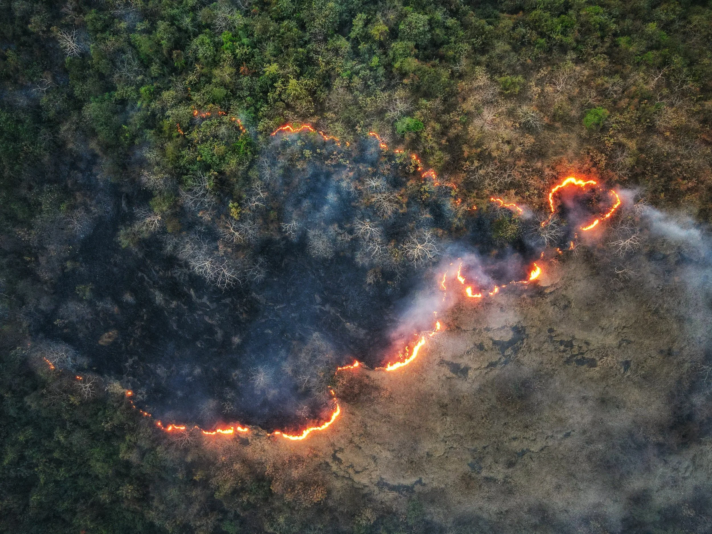
Wildfire and Hazard Reduction
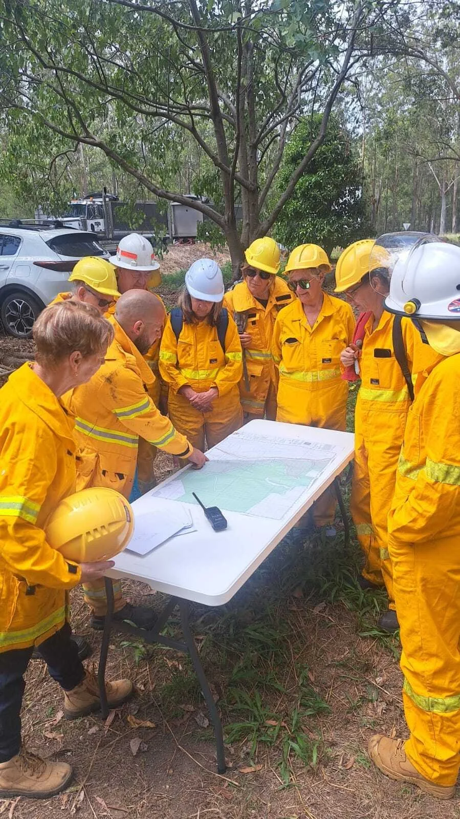
FireMapper is actively deployed in wildfire operations, supporting in-field mapping, real-time data collection and resource tracking across incidents. Used for fire trail maintenance and hazard reduction burn planning, it enhances off-season preparation and ensures teams are fully equipped for incident response. Fully integrated with CAD, turnout systems, GIS, SSO, AVL, and Incident Command platforms, FireMapper enables seamless information flow from the field to command centers. Deployed to the largest fire service in the Southern Hemisphere, FireMapper delivers a unified operational picture that improves situational awareness and decision-making across all phases of wildfire management.
Wildfires and other natural hazards pose significant risks to communities and the environment. FireMapper provides specialised tools and symbology to help agencies manage and mitigate these risks, ensuring a safer environment for all.
Benefits
The benefits of FireMapper for wildfire and hazard reduction efforts are substantial. Agencies can use FireMapper to track controlled burns, monitor wildfire perimeters, and coordinate response efforts more effectively. This leads to a reduction in the impact of wildfires and other hazards, protecting lives, property, and natural resources.
Operational Outcomes
By leveraging FireMapper's capabilities, agencies can improve their wildfire and hazard reduction efforts, leading to safer communities and a healthier environment. With real-time information and advanced mapping tools, agencies can make more informed decisions and respond more quickly to changing conditions, ultimately saving lives and reducing the impact of disasters.
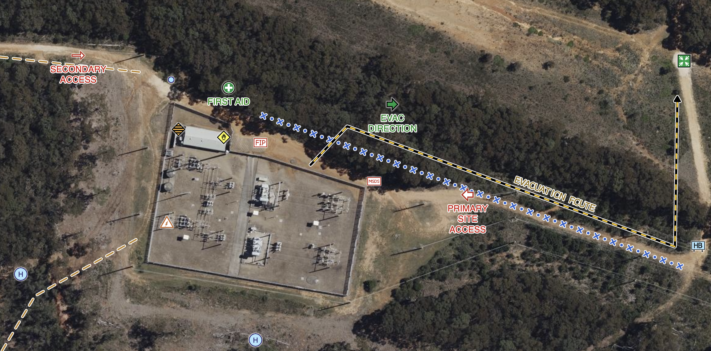
Pre-incident Planning
FireMapper is also a powerful planning tool, supporting pre-incident and training exercises. Through asset mapping, GIS-based scenario modelling, and the creation of shareable map tokens with controlled permissions, agencies can coordinate roles, define areas of responsibility, and streamline information flow before an emergency occurs.
Pre-incident planning is a critical aspect of emergency response, involving the development of detailed strategies and procedures to address potential hazards. FireMapper provides a comprehensive suite of tools for pre-incident planning, allowing agencies to create detailed maps and plans that can be accessed and updated in real-time.
Benefits
The benefits of FireMapper for pre-incident planning are immense. Agencies can easily record tracks, take photos, and identify key locations and assets, ensuring that all critical information is readily available during an emergency. This allows for faster and more coordinated response efforts, ultimately saving lives and minimizing damage to property.
Operational Outcomes
With FireMapper, agencies can improve their pre-incident planning processes, leading to more efficient and effective emergency responses. By having access to detailed maps and plans, first responders can quickly assess the situation and deploy resources where they are needed most, improving the overall safety and effectiveness of the response effort.
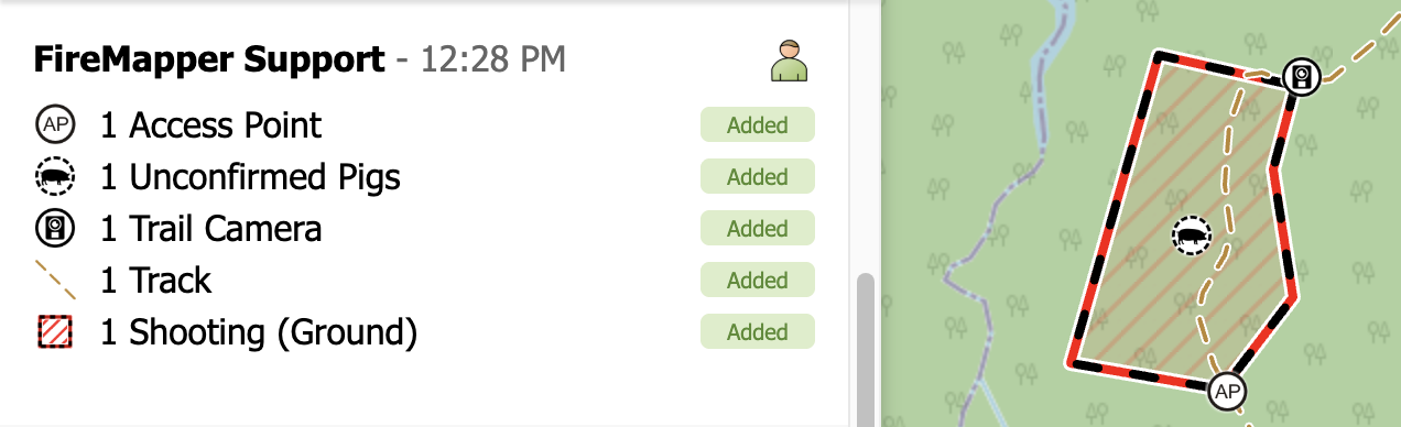
Land Management
FireMapper is also used in land management activities, supporting operations such as aerial spraying, weed treatment, hotspot mapping and fire hydrant asset mapping. This enables our customers/land managers to identify problem areas quickly, deploy resources efficiently and monitor treatment outcomes over time.
Australia's vast and diverse landscape presents unique challenges for land management, from invasive species to conservation efforts. FireMapper offers a comprehensive solution for tackling these challenges, providing tools that allow land managers to track and monitor environmental changes with precision and efficiency.
One of the key features of FireMapper for land management is its ability to track invasive species and other pests. Using the app, land managers can highlight areas affected by weeds or pests, such as blackberry or rabbits, and monitor their spread over time. This information is invaluable for developing targeted management strategies, allowing for more effective control and containment of these threats to native ecosystems.
FireMapper also supports land management practices such as treatment and spraying. The app allows users to map out treatment areas and track the progress of treatments, ensuring that resources are used efficiently and effectively. This level of detail and monitoring helps to minimise the risk of resistance developing in target species and allows for adjustments to be made based on real-time data and conditions in the field.
In addition to invasive species management, FireMapper can also be used for planning and monitoring land use practices. For example, land managers can use the app to map out areas designated for specific land uses, such as agriculture or conservation, and track changes over time. This information can be used to inform decision-making processes and ensure that land management practices are sustainable and environmentally responsible. Overall, FireMapper provides land managers with a powerful tool for managing and protecting Australia's unique and diverse landscape.
Search and Rescue
FireMapper enhances search and rescue operations by providing real-time GPS tracking of field teams, improving safety in dynamic and hazardous environments. It enables efficient search coverage by mapping completed and pending areas, preventing duplication, and ensuring no zones are missed. Wildlife and incident data can be logged and visualized in real time, helping teams identify hotspots, plan follow-up actions, and coordinate seamlessly with other responders.
Search and rescue operations are complex and challenging, requiring coordination and communication among multiple teams and agencies. FireMapper provides real-time mapping and tracking capabilities, enabling search and rescue teams to coordinate more effectively and respond more efficiently to emergencies.
Benefits
The benefits of FireMapper for search and rescue operations are significant. Search and rescue teams can use FireMapper to view, collect, and share operational information, ensuring that all team members are on the same page and able to work together seamlessly. This leads to faster response times and more successful rescue missions.
Operational Outcomes
With FireMapper, search and rescue teams can improve their operational outcomes, leading to more lives saved and fewer injuries. By having access to real-time information and advanced mapping tools, teams can make better decisions and deploy resources more effectively, ultimately improving the overall safety and effectiveness of their operations.
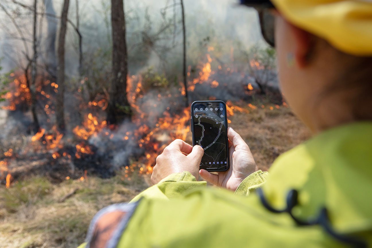
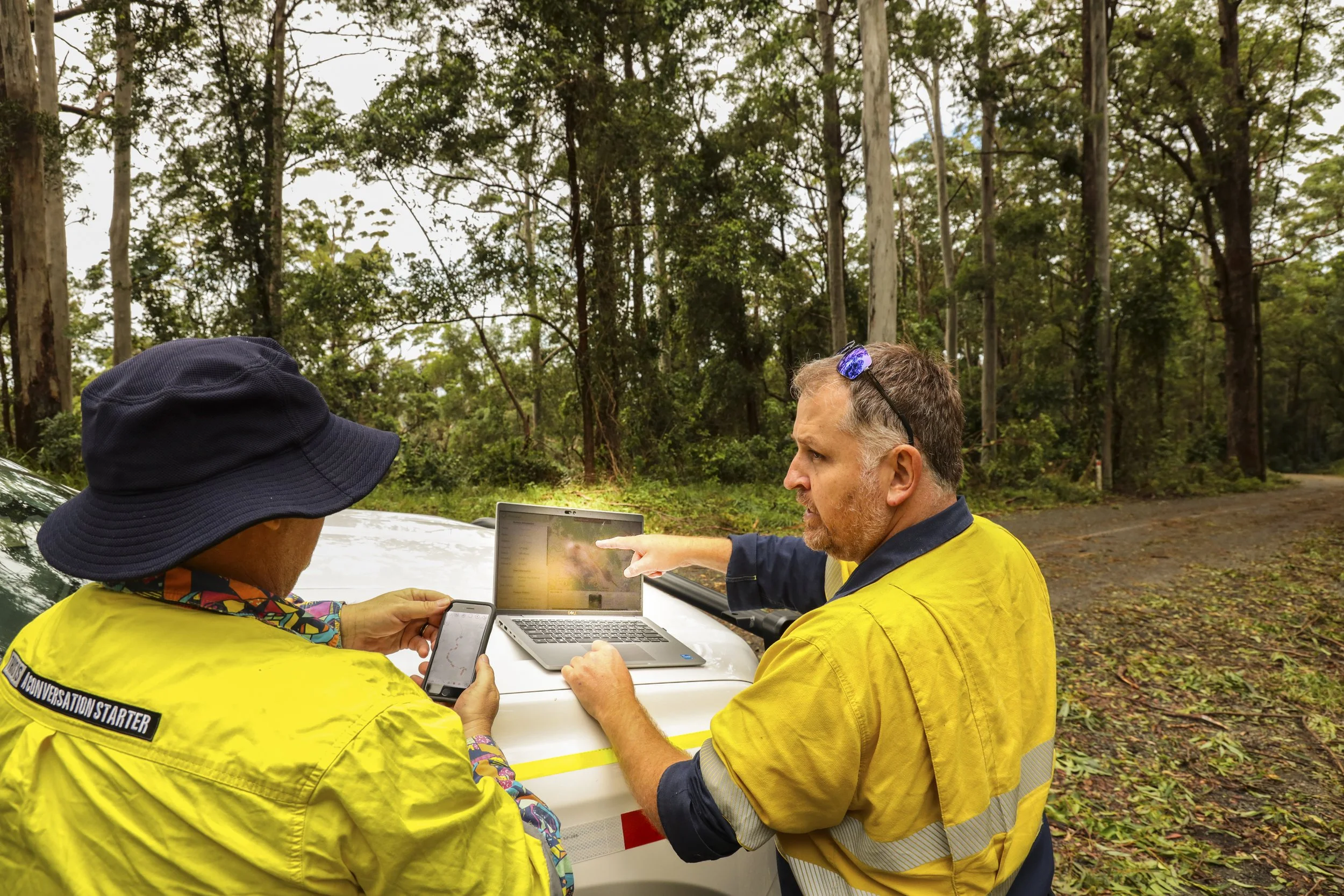
IFAW learning FireMapper and planning
Photo Credits: Scott Castle, IFAW
Disaster Response
FireMapper supports all-hazard disaster response by delivering rapid mapping, damage documentation, and field data collection capabilities. Agencies use the platform to coordinate multi-agency efforts, visualize impacts, and manage response activities efficiently across dynamic and complex incidents.
City of Moreton Bay personnel using FireMapper in the field